Empowering cities to embrace sustainability and take ESG decisions

SolutionsTechnologies

Our technology for global resilience. Data science for our planet’s health and future.

Our Technology

Thanks to our flexible and automated platform, with a zero-code approach, we can guarantee fast and rapid multi-temporal analyzes to identify risks impacting ecosystems and to offer decision support information in order to achieve the pre-set sustainable development goals. We offer you the ability to learn from the past, monitor the present and design sustainable places for the future. Latitudo 40 is not just a technology platform, but a complex environmental operating system that helps you in sustainability, resilience and urban development projects.

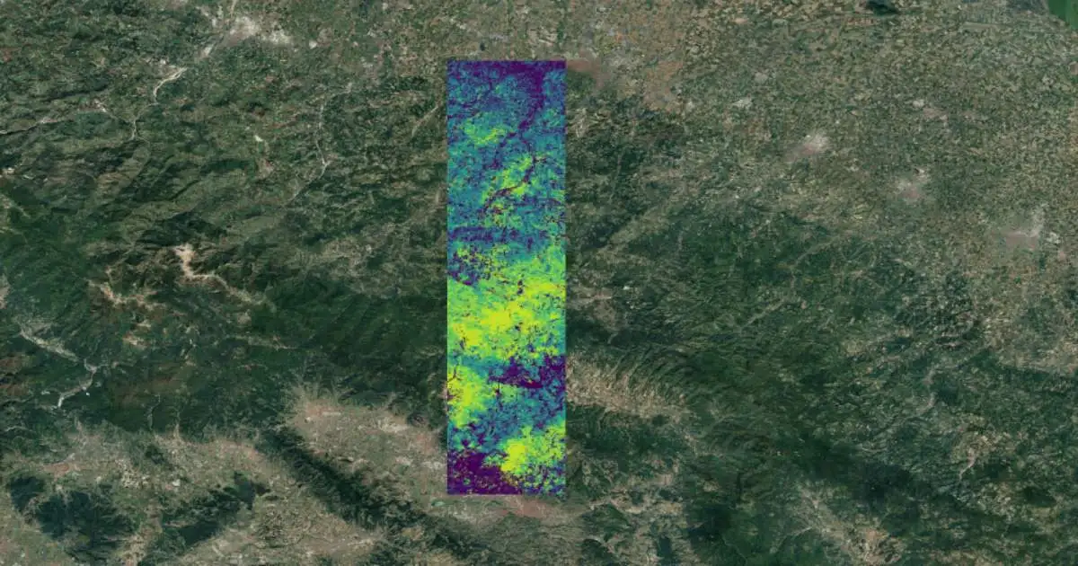
High Spatial Resolution Land Surface Temperature (LST) at 10m in Celsius Degrees (°C). The layer is obtained by applying Latitudo 40 proprietary Machine Learning algorithms to Copernicus Sentinel-2 to efficiently downscale the thermal information of the Landsat 8-9 MSI.

An innovative, fully automated, proprietary algorithm to calculate Urban Heat Islands from Sentinel-2 satellite images to identify urban temperature disparities and support strategies for climate adaptation and planning.

An innovative multi-temporal dataset based on our very high-resolution land cover map and a proprietary machine learning model, to calculate the ability of urban green infrastructure and forests to contribute to netZero goals by removing CO2 from the atmosphere.

With a Generative Adversarial Network algorithm, we offer images (10 spectral bands) and datsets with spatial resolution of 1 mt from Sentinel 2 images. A powerful tool for agritech, object and change detection applications at extremely low cost.

Surface albedo in rural and urban environments is one of the most influential parameters in assessing the effects of solar radiation on the earth's surface. A key dataset for the study of UHI and possible effects of risk mitigation plans.

Dataset based on a variant of a convolutional network used in multiple application scenarios (U-Net) for automatic identification and classification of green infrastructure in urban environments, health status and microclimate performance analysis of green areas.

Our Innovations

Platform Overview

A flexible platform that uses a zero-code approach to guarantee you quick and easy access to the most useful information to achieve the set sustainable development goals.

Data Space

An interface that collects and displays all the most useful, valuable and interesting data extracted from satellite images.

The data contained within our dashboard is organized for you to better analyse, understand and solve the global problems of our planet.

Super Resolution

The innovation of an algorithm that allows you to translate SAR images into optical images, making incredible improvements in terms of resolution.

SuperSAR is one of the latest technology additions to our platform.

Urban Simulator

Latitudo 40 Place Simulator is a tool capable of simulating and evaluating future urban scenarios using exclusively satellite images.


It's time to make sustainable decisions for the planet. Thanks to our platform, everything will be simpler and more effective.

Climate: Sustainably Revolutionized with Earth Observation

Climate: Sustainably Revolutionized with Earth Observation

In the face of accelerating climate change, Earth Observation (EO) technologies have emerged as powerful tools, revolutionizing the landscape of climate finance. These technologies not only provide critical insights into the impacts of climate change but also play a...

Joining the Data Space for Smart and Sustainable Places

Joining the Data Space for Smart and Sustainable Places

We are excited to announce our participation in the Data Space for Smart and Sustainable Cities and Communities (DS4SSCC) initiative, funded by the European Commission. The DS4SSCC initiative brings together a diverse consortium of partners, including municipalities,...

Latitudo 40 at South Summit 2023, Madrid

Latitudo 40 at South Summit 2023, Madrid

We had the opportunity to participate at the South Summit 2023 in Madrid. As finalists in the Mobility and Intelligent Cities category, we had the opportunity to showcase our innovative solutions and connect with industry leaders, investors, and fellow entrepreneurs...

Latitudo 40 at the ChangeNOW 2023 in Paris

Latitudo 40 at the ChangeNOW 2023 in Paris

Last week Latitudo 40 had the incredible opportunity to attend ChangeNOW 2023 in Paris, a three-day summit that brings together the greatests ideas and minds fighting for sustainability and against climate change. During the event, hosted in the Grand Palais Éphémère,...

Carbon Neutrality: Key to a Zero Emission Economy

Carbon Neutrality: Key to a Zero Emission Economy

Tracking the concentration of carbon dioxide, the main catalyst for global warming released into the Earth’s atmosphere as a result of human activity, is necessary in order to understand whether we are on track to prevent climate change. However, the gas, which comes...

Precision Farming: efficiency and prospects

Precision Farming: efficiency and prospects

Precision farming is an innovative method in agriculture using the latest technologies to improve crop quality. Precision farming technologies involve the use of accurate remote sensing data, such as images or videos from drones or satellites. Such images allow you to...

Supported By