.svg)


.svg)
.webp)
Topic
Text
Urban Green Navigator is being piloted in Turin within the ToMove project, introducing a climate-aware mobility system powered by satellite data and AI. The platform integrates environmental indicators into mobility decisions, supporting citizens, public administrations, and businesses with actionable insights. By combining real-time data, ESG metrics, and user engagement, the project advances sustainable urban mobility and contributes to building more resilient, data-driven cities.
Article
Content
ToMove Project: Advancing Sustainable Urban Mobility through Data-Driven Innovation
The ToMove project Turin is an urban mobility innovation program designed to accelerate the transition toward data-driven urban mobility and climate-resilient cities. Developed within the ToMove4Future framework, the initiative enables the testing of advanced digital solutions that enhance how mobility systems are planned, monitored, and optimized in complex urban environments.
The program brings together a multi-stakeholder ecosystem, including the City of Turin, local innovation hubs such as i3P (Innovative Companies Incubator of Politecnico di Torino) and OGR Torino, alongside corporate partners like Intesa Sanpaolo, supporting experimentation and user engagement. This collaborative structure reflects a broader sustainable mobility project in Europe approach, where public institutions, research centers, and private actors co-develop scalable solutions.

Within this context, Latitudo40 introduces Urban Green Navigator as a smart mobility pilot in Italy, leveraging satellite data and artificial intelligence to integrate environmental variables into routing systems. The experimentation aims to validate how geospatial intelligence can support climate-resilient urban mobility, reducing environmental exposure and enabling more informed mobility behaviors.
The Turin pilot represents a critical step toward operationalizing Earth Observation technologies in real-world mobility ecosystems, aligning innovation with measurable environmental impact.
Urban Green Navigator: A Climate-Aware Mobility System Powered by Earth Observation
Urban Green Navigator is designed as an advanced climate-aware mobility system, not merely a routing tool, but a modular platform that integrates Earth Observation urban mobility data, artificial intelligence, and user-generated inputs to optimize mobility at multiple levels. As part of Latitudo40’s technological ecosystem, it operates as a service layer within EarthDataInsights®, enabling the fusion of satellite-derived environmental intelligence with real-time urban mobility dynamics.
At its core, the system leverages satellite data mobility pipelines to process high-resolution geospatial layers such as Land Surface Temperature (LST) and Tree Cover Density (TCD), which quantify urban heat distribution and green infrastructure presence. These datasets are continuously analyzed through AI models to generate environmental indicators that feed the platform’s decision engines, supporting AI mobility optimization and dynamic, context-aware mobility scenarios.
Urban Green Navigator is built on a scalable architecture where routing is only one component of a broader sustainable mobility technology framework. The platform ingests, processes, and redistributes data across multiple interfaces, enabling integration with external systems such as MaaS platforms and urban digital twins. This approach transforms geospatial data routing into a source of actionable intelligence for both users and institutions.
Looking ahead, the system is evolving toward the integration of more advanced climate indicators, including Physiological Equivalent Temperature (PET)—a satellite-derived index that captures human thermal stress by combining radiative fluxes, humidity, and wind conditions. Additionally, experimental air quality models based on traffic-derived emissions will further enhance the platform’s capability to support health-aware mobility decisions.
By combining environmental analytics with mobility intelligence, Urban Green Navigator establishes a new paradigm for data-driven, climate-resilient urban mobility systems.
Enhancing Daily Mobility: Benefits of Urban Green Navigator for Citizens
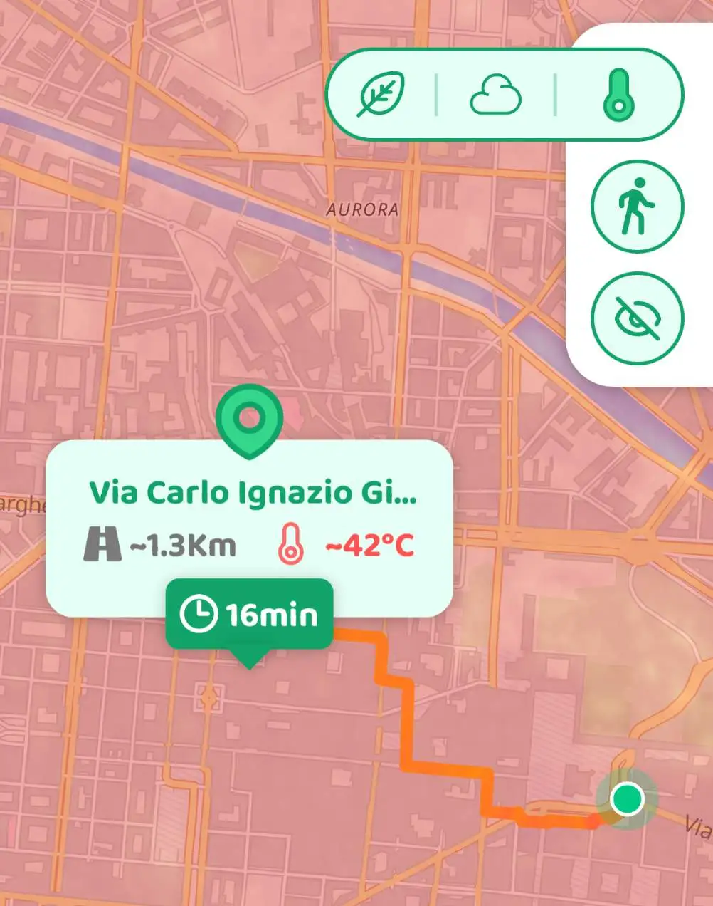
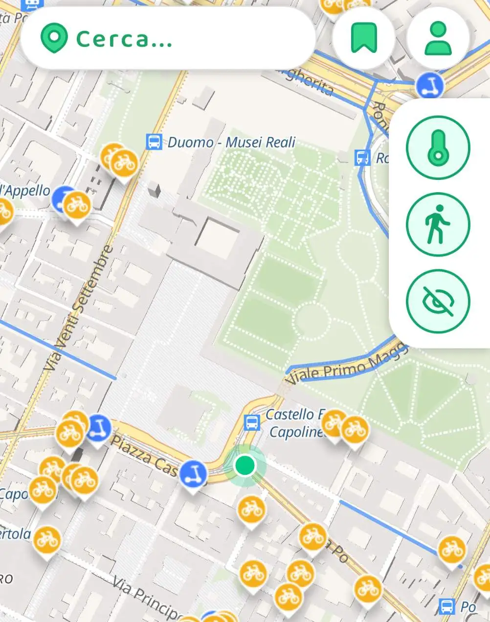
Urban Green Navigator enhances everyday mobility by combining satellite navigation for pedestrians and cyclists with real-time environmental data in route planning, enabling safer, healthier, and more sustainable travel choices. The system supports active mobility by integrating environmental intelligence directly into the user experience, shifting route selection from purely time-based to exposure-aware decision-making.
Unlike conventional navigation tools, the platform dynamically suggests routes that minimize exposure to air pollution hotspots, urban heat islands, and low-green areas, contributing to improved urban wellbeing. This is particularly relevant in European cities, where short-distance trips (under 5 km) account for a significant share of daily mobility and can be effectively shifted toward walking and cycling.
Key benefits for citizens include:
- Reduced environmental exposure
Routes are optimized to avoid high-temperature zones and polluted corridors, lowering health risks linked to heat stress and poor air quality
- Improved physical and mental wellbeing
Active mobility is associated with up to a 20–30% reduction in cardiovascular risks and measurable improvements in mental health
- Time-efficient sustainable alternatives
In dense urban areas, cycling can be up to 50% faster than cars during peak hours
- Gamification and behavioral change in mobility
Incentive mechanisms reward low-impact travel choices, encouraging long-term adoption of sustainable habits
By aligning personal mobility with environmental conditions, Urban Green Navigator transforms daily commuting into a data-informed, health-oriented experience, supporting both individual wellbeing and broader urban sustainability goals.
Data-Driven Urban Planning: Urban Green Navigator for Public Administrations
Urban Green Navigator provides public authorities with an advanced urban mobility analytics platform, transforming mobility data into actionable insights for climate data urban planning and ESG urban governance. By integrating satellite-derived environmental layers with real-time mobility data, the system enables evidence-based decision-making without requiring additional physical infrastructure.
Through dedicated dashboards, public administrations can monitor and optimize urban mobility systems with high spatial and temporal resolution.
Key capabilities include:
- CO₂ monitoring urban mobility
Quantification of avoided emissions from modal shifts toward walking and cycling, supporting decarbonization strategies
- Identification of environmental criticalities
Detection of urban heat islands and low-green areas to guide infrastructure investments (e.g. green corridors, shaded routes)
- Mobility flow analysis
Aggregated insights on user behavior to improve traffic distribution and reduce congestion
- Policy impact assessment
Data-driven evaluation of sustainable mobility interventions
Soft mobility adoption can reduce urban transport emissions by up to 30% and significantly decrease congestion levels. In this context, Urban Green Navigator acts as a scalable public administration sustainability tool, enabling cities to transition toward more resilient and efficient mobility systems.
ESG and Corporate Mobility: Urban Green Navigator for Businesses
Urban Green Navigator extends its capabilities to the corporate domain, providing advanced mobility manager tools to address the growing complexity of corporate sustainable mobility and ESG compliance. Today, employee commuting represents a critical component of scope 3 commuting emissions, often accounting for 20–30% of total corporate carbon footprints, yet remains one of the least controlled variables.
Mobility managers are facing increasing pressure from multiple fronts:
- Regulatory requirements (e.g. mandatory mobility plans in large organizations)
- ESG reporting standards demanding measurable, auditable data
- Cost optimization needs linked to inefficient commuting patterns
- Employee expectations for flexible and sustainable mobility options
In this context, Urban Green Navigator enables data-driven employee mobility analytics, transforming commuting behaviors into quantifiable ESG metrics.
.jpg)
Key capabilities include:
- ESG mobility solutions
Accurate tracking of CO₂ emissions avoided and integration into sustainability reporting frameworks
- Scenario-based planning
Simulation of modal shifts (e.g. car → bike) to evaluate environmental impact
- Behavioral engagement
Gamification mechanisms to incentivize low-carbon commuting choices
By converting fragmented mobility data into structured insights, the platform supports organizations in aligning mobility strategies with ESG targets, improving both environmental performance and corporate accountability.
Pilot Launch in Turin: Testing Urban Green Navigator within ToMove
The launch of Urban Green Navigator in Turin marks the operational phase of a urban mobility pilot project within the ToMove initiative, positioning the city as a living lab for smart mobility testing and climate tech pilot Italy solutions. The experimentation is designed to validate the system in real-world conditions, collecting high-resolution data on mobility patterns, environmental exposure, and user behavior.
During the pilot, the platform will be progressively integrated into the local mobility ecosystem, enabling continuous optimization of routing algorithms and environmental models. The testing phase also focuses on user engagement, leveraging feedback and usage data to refine both the technological infrastructure and the overall user experience.
Turin citizens play a central role in this process: every route generated contributes to building a more accurate, data-driven understanding of sustainable mobility Turin, supporting future urban planning decisions and climate resilience strategies.
If you are based in Turin, you can actively contribute to shaping the future of urban mobility.
Download the app, start navigating, and participate in a smart city project that transforms your daily movements into measurable environmental impact.


.webp)