
.svg)


.svg)


_11zon.webp)
Topic
Text
Climate change is reshaping real estate investment risk. This article explains how physical climate risk and transition risk can turn properties into stranded assets by affecting operating costs, CAPEX, insurance, financing, liquidity and asset valuation. It explores how Earth Observation, AI and geospatial intelligence support asset-level climate risk assessment, portfolio screening and monitoring, helping real estate stakeholders identify exposure, prioritize interventions and build more climate-resilient investment strategies.
Article
Content
What Are Stranded Assets?
Stranded assets are physical or financial assets that lose economic value, profitability, or intended use before the end of their expected useful life. Stranding can result from external changes that alter the conditions under which an asset remains economically viable, including environmental pressures, regulation, technological disruption, changing market demand, and evolving social expectations.
Although the concept has historically been associated with fossil fuel infrastructure, stranded asset risk extends across sectors and asset classes, including real estate. For property owners, investors, and asset managers, an asset may become stranded when changing conditions make it increasingly difficult or costly to operate, maintain, finance, insure, or sell it at its expected value. Climate change is therefore becoming an increasingly relevant component of real estate climate risk and long-term investment risk.
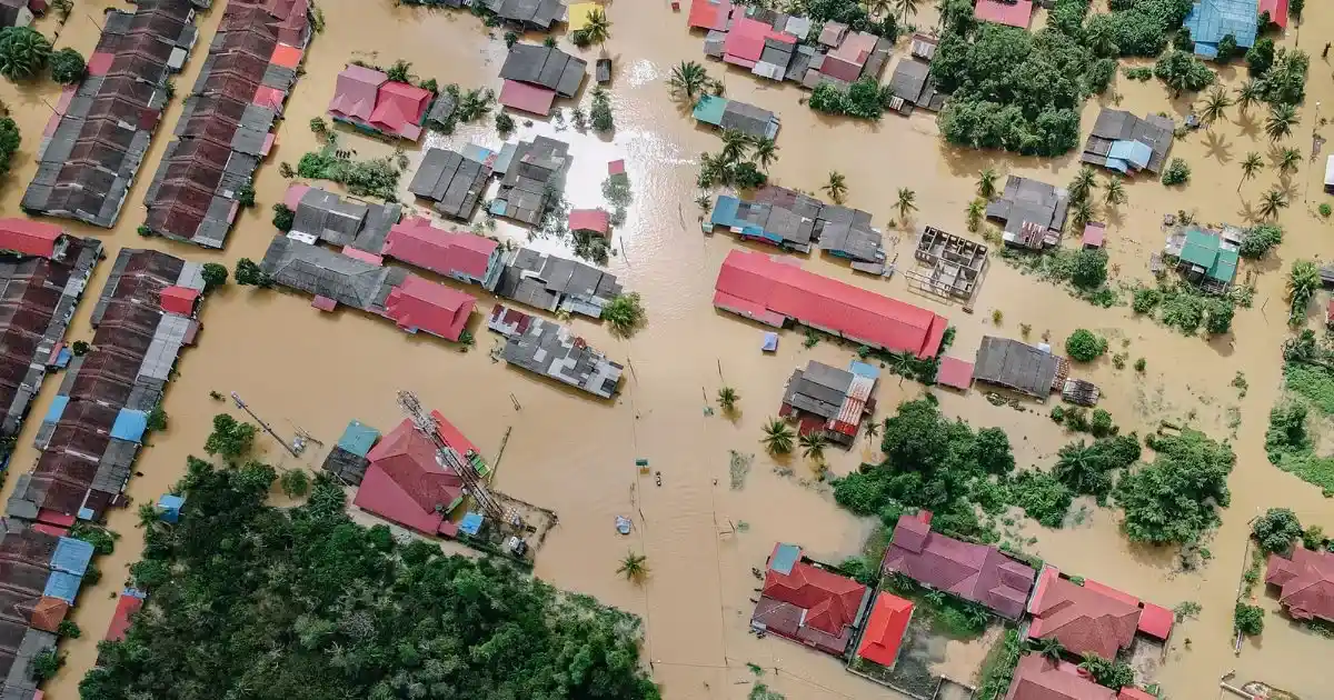
In this context, climate risk in real estate is not limited to physical damage. Both physical climate risk and transition risk can affect an asset's economic performance and investment profile, potentially resulting in premature write-downs or loss of value. Identifying these exposures early is therefore an essential step in effective climate risk assessment and climate risk management.
How Climate Change Can Turn Real Estate into Stranded Assets
Climate change can expose real estate to two interconnected categories of physical climate risk. For property owners and investors, these climate hazards can affect buildings differently depending on location, exposure and vulnerability. A robust real estate climate risk assessment therefore needs granular, asset-specific analysis to identify where physical climate risks may translate into material financial exposure.
Physical Climate Risk
Physical climate risk in real estate arises when climate-related hazards affect an asset’s physical integrity, operations, or ability to generate value. Acute physical risk comes from sudden events such as floods, wildfires, storms and extreme precipitation, potentially causing direct damage and operational disruption. Chronic physical risk develops progressively through persistent changes such as rising temperatures, drought, sea-level rise and changing precipitation patterns.
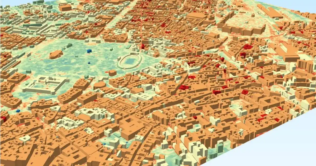
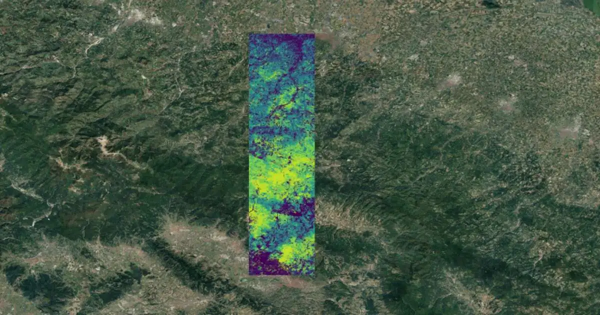
In this picture: an analysis of builinding exposure in Bologna.
The exposure of a property depends not only on the hazard itself, but also on its location, physical characteristics, condition and adaptive capacity. Consequently, the same hazard can produce materially different impacts across assets. A robust assessment of physical climate risks in real estate therefore requires granular analysis of hazard, exposure and vulnerability rather than relying solely on regional averages.
Transition Risk
Transition risk arises when the shift toward a low-carbon economy changes the regulatory, technological and market conditions under which real estate assets operate. For property owners and investors, four areas are particularly relevant:
- Climate regulation: stricter building codes, carbon pricing and energy-performance standards can require costly compliance measures.
- Energy performance: poor building energy efficiency can increase operating costs, retrofit requirements and exposure to future regulation.
- Market expectations: tenants, buyers and investors may increasingly favour efficient, low-emission properties, affecting demand and liquidity.
- Technology: the adoption of cleaner energy systems can accelerate the obsolescence of inefficient buildings and existing technologies.
Together, these factors can make assets economically less competitive and increase the probability of transition risk real estate exposure and premature stranding.
From Climate Exposure to Asset Devaluation
Climate exposure affects asset valuation when it changes the expected economic performance or risk profile of a property. Physical damage, operational disruption and adaptation requirements can increase operating costs, insurance premiums and climate-related CAPEX, reducing expected net operating income. At the same time, perceived exposure can affect financing conditions, liquidity and investor demand, increasing the risk premium required to hold the asset.
In valuation terms, these effects can reduce expected future cash flows and, where appropriate, increase the discount or capitalization rate applied to them. The result can be a lower property valuation, even before a major loss occurs. Climate risk asset valuation therefore requires assessing how exposure translates into changes in income, costs, capital requirements and the risk-adjusted value of future cash flows.
How Earth Observation Supports Stranded Asset Risk Management
Earth Observation (EO) provides the spatial and temporal intelligence needed to translate climate risk into asset-level evidence. By combining satellite observations with geospatial data and AI-driven analytics, investors can move beyond broad regional assessments and identify how environmental conditions affect specific properties and portfolios.
This enables a more systematic climate risk assessment based on location-specific exposure, observed changes and comparable indicators. For real estate stakeholders, EO can therefore support climate risk management across the investment lifecycle—from screening and due diligence to monitoring and portfolio prioritization.

Asset-Level Climate Risk Mapping
The first advantage of Earth Observation is its ability to connect environmental conditions with the precise location and characteristics of an asset. Instead of treating climate exposure as a regional average, geospatial analysis can identify the specific hazards surrounding a property and assess their spatial relationship with the asset itself. Flood-prone areas, elevated surface temperatures, vegetation conditions, land characteristics and other environmental indicators can be mapped against individual properties.
This asset-level approach is particularly relevant for real estate portfolio risk, where properties within the same geographic region may have materially different exposure profiles. Precise geolocation and granular environmental data allow investors to distinguish between assets that require further assessment and those with comparatively lower exposure. Research on stranded assets has similarly highlighted the importance of accurate asset-level geographic information for improving environmental risk assessment.
Monitoring Environmental and Structural Changes
Climate risk management is not a one-off exercise. Environmental conditions surrounding an asset can evolve over months or years, changing its exposure and potentially altering its risk profile. Earth Observation makes it possible to establish a temporal baseline and monitor these changes consistently.
For real estate stakeholders, this can include tracking variations in surface temperature, vegetation, land cover, development patterns and other environmental indicators. Multitemporal observations can also support the detection of changes that may require further investigation before they become material to asset performance.
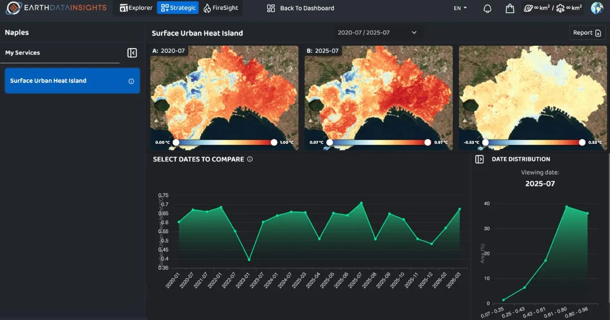
This temporal dimension is particularly valuable for portfolio managers. Rather than relying exclusively on periodic inspections or static datasets, they can incorporate continuously updated geospatial evidence into their monitoring processes. Latitudo 40's EarthDataInsights, for example, allows users to analyse environmental conditions across different historical periods and monitor how territories evolve over time.
From Hazard Mapping to Economic Impact
Mapping a climate hazard is only the starting point of a useful risk assessment. For investors, the relevant question is how exposure can affect the economic performance of an asset.
The analytical process can therefore be structured as:
Hazard → Exposure → Vulnerability → Potential Impact → Financial Consequences
This approach connects geospatial information with the variables that matter to investment decisions. For example, flood exposure can be combined with asset location and characteristics to estimate potential damage; heat indicators can help identify properties facing increasing thermal stress and cooling requirements; environmental change can reveal conditions that may require adaptation or further technical assessment.
The objective is not to replace conventional valuation or engineering models, but to provide a spatial evidence layer that strengthens them. EO-derived indicators can therefore become inputs for climate risk assessment, due diligence, scenario analysis and the evaluation of potential adaptation requirements.
Portfolio-Level Risk Screening and Prioritization
For large real estate portfolios, the challenge is not simply identifying climate exposure—it is deciding where analytical and financial resources should be allocated first. Earth Observation enables a consistent screening framework across multiple assets and geographies, helping investors compare exposure and identify priority locations.
A portfolio-level workflow can support:
- Risk screening: identify assets exposed to relevant climate hazards.
- Risk ranking: compare relative exposure across properties or geographies.
- Prioritization: identify assets requiring detailed technical assessment or intervention.
- CAPEX planning: support the prioritization of adaptation and resilience investments.
- Ongoing monitoring: track changes in environmental conditions after an intervention.
This scalability is particularly relevant to asset managers dealing with geographically distributed portfolios. Rather than assessing every property with the same level of intensity, geospatial intelligence can provide an initial risk filter and direct more detailed analysis towards the assets with the greatest potential exposure.
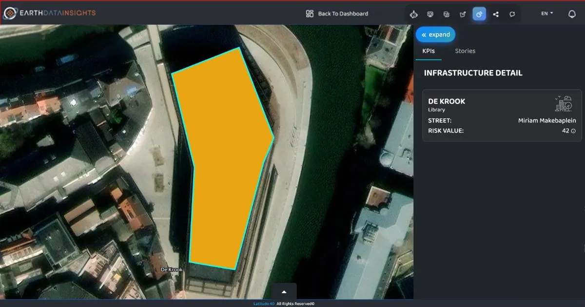
How Latitudo 40 Helps Real Estate Stakeholders Manage Climate Risk
Latitudo 40 applies this approach by combining Earth Observation data, AI-driven analytics and geospatial intelligence to transform complex environmental information into actionable indicators. Its technology stack integrates satellite imagery and other environmental datasets, processes them through AI and machine-learning models, and delivers the resulting information through interactive tools and data products.
Environmental and Urban Risk Intelligence
Latitudo 40 provides two complementary ways of accessing this intelligence.

EarthDataInsights is a SaaS platform designed to monitor environmental change and climate risks through interactive geospatial dashboards. It provides access to indicators including Land Surface Temperature, Surface Urban Heat Island, Heat Potential Risk, Flooding Risk, Tree Height and many more environmental variables, together with historical monitoring capabilities.

EarthDataPlace, meanwhile, provides ready-to-use geospatial datasets and analyses that can be integrated into third party systems and workflows. This model is particularly relevant for organizations that already have their own analytical, risk or asset-management infrastructure and need reliable environmental data as an additional intelligence layer.
Together, these solutions support a holistic approach: from accessing the underlying geospatial information to interpreting climate indicators and incorporating them into decision-making processes. The integration of higher-resolution satellite imagery with Latitudo 40's AI models further enables more granular environmental analysis and more responsive climate intelligence.
Physical Climate Risk
Physical climate risk is one of the most direct applications of this approach. Latitudo 40 provides geospatial indicators that can help stakeholders identify and assess exposure to environmental conditions affecting buildings, infrastructure and surrounding areas.
Flooding Risk is assessed through the integration of satellite and environmental data, including Sentinel-1, Sentinel-2, digital elevation models and ERA5 datasets. The resulting analysis can support the identification of areas prone to flooding and provide an additional evidence layer for applications including real estate and insurance.
Heat Risk can be investigated through Land Surface Temperature, Surface Urban Heat Island and Heat Potential Risk indicators. Latitudo 40's Heat Potential Risk methodology combines temperature-related hazard with exposure and morphological vulnerability to produce a risk index, allowing stakeholders to identify areas where heat-related impacts may be more significant.
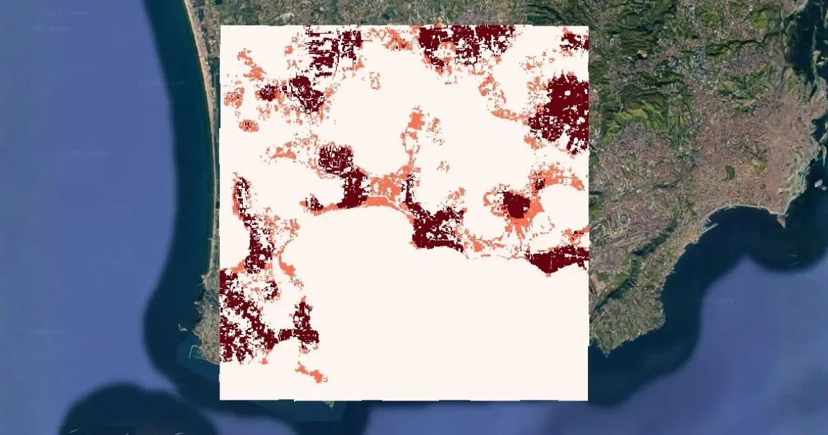
Seismic Risk is assessed by our Seismic Risk assessment data processing pipeline, evaluating earthquake exposure at urban scale by combining seismic hazard with population density, land use, building height and terrain characteristics. The resulting 30 m spatial indicator integrates hazard, exposure and vulnerability to support real estate and portfolio risk assessment.
Beyond individual hazards, environmental indicators such as vegetation, tree cover, land characteristics and building morphology can provide additional context for understanding an asset's surrounding conditions. This broader geospatial perspective is essential when assessing physical climate risk at both asset and portfolio scale.
Transition Risk
Latitudo 40 supports the assessment of transition risk in real estate by providing geospatial intelligence on energy performance, renewable potential and the environmental conditions influencing buildings and energy systems.
Earth Observation and AI can help identify areas with different levels of energy demand, assess the suitability of buildings and surfaces for renewable energy generation, and monitor variables such as surface temperature and land characteristics.
_11zon.webp)
These insights can support the evaluation of building energy efficiency, the identification of potential retrofit needs and the planning of renewable energy solutions. By integrating spatial evidence with energy and asset data, real estate stakeholders can better understand how changing energy requirements, technologies and market conditions may affect asset performance and future investment needs.
This provides an additional data layer for climate transition risk assessment, supporting more informed decisions on upgrades, CAPEX allocation and long-term asset resilience.
From Stranded Asset Risk to Climate-Resilient Investment Decisions
Climate change does not automatically make an asset stranded. The relevant risk emerges when physical exposure or transition pressures begin to alter its economic fundamentals, market position or long-term viability. For real estate investors, managing this risk requires connecting environmental evidence with financial decision-making.
Earth Observation can provide an important bridge between environmental evidence and financial decision-making. By making climate exposure measurable at asset and portfolio level, monitoring how conditions evolve and supporting the prioritization of higher-risk properties, geospatial intelligence can help investors move from broad climate assumptions to evidence-based action.
For asset managers and real estate stakeholders, this means incorporating climate intelligence earlier into due diligence, portfolio risk management, CAPEX planning, asset monitoring and investment decisions. The objective is not simply to identify today's risks, but to understand how changing environmental conditions could affect the future performance and value of real estate assets—and to act before exposure becomes material.
That is the foundation of a more proactive approach to climate-resilient investment and, ultimately, more resilient real estate portfolios.
Do you want to learn more?
%202.webp)
.webp)

.webp)


