
.svg)


.svg)
Topic
Text
AgriLiv Network is an Agritech project that develops Living Labs and a geospatial digital platform to support smart and green agriculture. With Earth Observation, satellite data, and Decision Support Systems, farmers gain actionable insights for irrigation, fertigation, and soil health monitoring. Latitudo40 leads experimental studies on tomato fields, focusing on Soil Organic Carbon, proving how data-driven innovation drives sustainability.
Article
Content
Agritech and the vision behind Agriliv Network
The agrifood sector is undergoing a profound transformation, driven by the urgent need to balance productivity with sustainability. Agritech represents the integration of advanced technologies, such as digital platforms and precision farming tools, that enable farmers to optimize resources, reduce inputs, and minimize environmental impact. In this framework, the AgriLiv Network project was created as part of Italy’s PNRR within the Agritech National Centre program to accelerate the transition towards more resilient agricultural systems.
The project’s vision is to connect research, industry, and end users through a collaborative structure that makes innovation accessible and applicable at scale. Rather than limiting technology to experimental plots, AgriLiv Network fosters widespread adoption by building a system where farms and institutions can interact seamlessly. This approach not only enhances the scientific validation of new methods but also strengthens their practical integration into everyday farming.
AgriLiv Network focuses particularly on challenges that remain central for European agriculture: efficient water management, sustainable fertilization, soil carbon monitoring, and crop protection strategies. By leveraging digital decision support systems and geospatial intelligence, the project aims to provide farmers with actionable tools to improve yields while reducing ecological footprints.
At its core, AgriLiv Network is not only a research initiative but also an infrastructure for long-term knowledge transfer. Its ultimate goal is to ensure that green agriculture principles are embedded into agricultural practices, preparing the sector to face climate variability, market demands, and environmental regulations with innovative data-driven solutions.
Living Labs for sustainable and smart agriculture
The concept of Living Labs has become central to European innovation policies, particularly in agriculture, where systemic transformation requires participatory approaches. A Living Lab is an open, collaborative environment where stakeholders - researchers, farmers, technology providers, institutions, and end users - co-design, test, and validate solutions in real-world conditions. Unlike conventional research trials, Living Labs are embedded within the production cycle, enabling continuous feedback and ensuring that innovation is not only scientifically sound but also operationally relevant.
Within AgriLiv Network, Living Labs act as the primary drivers of knowledge generation and technology adoption. They provide the space where advanced digital tools and Earth Observation insights are confronted with everyday agricultural practices. For instance, pilot Living Labs included in the project focus on critical areas such as water management, fertigation models, and soil carbon monitoring. By integrating these elements, AgriLiv Network creates a comprehensive testing ground for both environmental and economic sustainability.
The role of Living Labs in this initiative is twofold. First, they allow for the validation of innovative practices under diverse agronomic and climatic conditions, ensuring scalability beyond local experiments. Second, they build trust between technology developers and farmers, reducing the gap that often prevents the uptake of advanced solutions in the agrifood sector. By involving ambassadors—technical experts representing each Living Lab—and testimonials—farmers directly adopting the innovations—the project establishes a strong communication and feedback mechanism, increasing the chances of long-term adoption.
Another defining feature of AgriLiv’s Living Labs is their integration into a networked structure. This is not a collection of isolated experiments but a coordinated ecosystem connected through a digital platform. The virtual network allows for data sharing, benchmarking of practices, and cross-fertilization of ideas among different agricultural domains. This approach significantly enhances the resilience of the agrifood system by ensuring that lessons learned in one context can be rapidly transferred and adapted to others.
By applying the Living Lab methodology, AgriLiv Network addresses key challenges of smart agriculture: optimizing water use, reducing input costs, and monitoring environmental impacts through quantifiable indicators. The outcome is a model where innovation is not only tested but also embedded into decision-making processes, ensuring that sustainability goals align with farmers’ productivity and profitability needs.
In sum, Living Labs within AgriLiv Network embody a paradigm shift for green agriculture: they move beyond traditional top-down research to foster a collaborative, data-driven ecosystem that accelerates the transition towards climate-resilient and resource-efficient farming.
A geospatial digital platform powered by Earth Observation
One of the most strategic outcomes of the AgriLiv Network is the creation of a geospatial digital platform designed to collect, manage, and analyze agricultural data in a unified and actionable way. This platform functions as the digital backbone of the project, connecting the different Living Labs and enabling farmers, researchers, and institutions to collaborate through shared datasets and tools.
The platform is based on a Geographic Information System (GIS), a digital framework that integrates spatial data with descriptive information to support mapping, analysis, and decision-making.
A GIS is much more than a simple cartographic tool: it allows users to visualize layers of geographic information such as soil conditions, crop health, or water distribution on a map, and to combine them with other datasets to identify patterns, relationships, and trends. Modern GIS platforms are interactive and dynamic, enabling real-time queries and simulations that are essential in precision agriculture. In the context of AgriLiv Network, GIS technology provides the structural foundation for comparing results across pilot sites, scaling up innovations, and translating raw data into operational intelligence.
The platform integrates multiple data sources, including Earth Observation from satellites, in-field sensors, and crop models. This multi-layered approach makes it possible to monitor key variables such as soil moisture, evapotranspiration, and vegetation indices with high spatial and temporal resolution. Farmers can thus optimize resource use—adjusting irrigation schedules, tailoring fertilization plans, or anticipating pest outbreaks—based on evidence rather than estimates.
A central feature of the system is the incorporation of Decision Support Systems (DSS), advanced software solutions that process complex datasets and generate tailored recommendations. In agriculture, DSS combine weather forecasts, crop growth models, and remote sensing imagery to suggest practical actions, such as when to irrigate, how much fertilizer to apply, or which fields are most at risk of disease. By embedding DSS functionalities, the AgriLiv platform transforms diverse datasets into actionable insights, directly supporting smart agriculture practices.
The platform is also designed as a collaborative environment. Beyond visualization, it allows for benchmarking across Living Labs, facilitating the exchange of methodologies and results. For example, an irrigation protocol validated in one pilot site can be compared with conventional practices in another, providing measurable indicators of both productivity and environmental impact. This capacity for cross-comparison ensures that innovation is not confined to isolated contexts but can be adapted and replicated on a larger scale.
Finally, the platform contributes to knowledge transfer and capacity building. Equipped with user-friendly interfaces accessible from multiple devices, it serves not only as an operational tool but also as a training resource. Farmers, advisors, and policymakers can access tutorials, explore simulated scenarios, and learn how digital agriculture can support green agriculture objectives.
By combining GIS architecture, satellite data, and DSS analytics into a single system, the AgriLiv digital platform turns fragmented information into a coherent infrastructure for evidence-based farming. It represents a decisive step towards a connected, data-driven, and sustainable agrifood system.
Latitudo40’s experimental studies with satellite data for Agritech
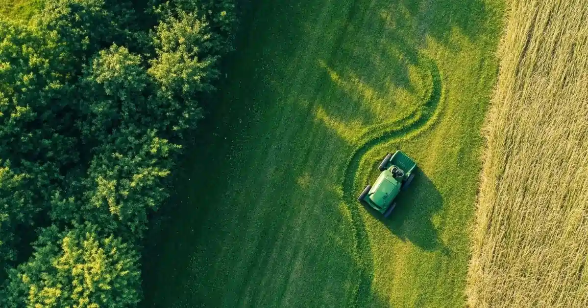
Within the AgriLiv Network, Latitudo40 plays a pivotal role by applying its expertise in Earth Observation and data analytics to experimental studies in open-field conditions. The company is conducting three large-scale trials on tomato crops, each covering more than seven hectares. These experimental fields provide the framework to compare traditional management practices with innovative Decision Support Systems (DSS) that optimize irrigation, fertigation, and crop protection strategies.
The objective is twofold: to assess the agronomic and economic performance of DSS-based management, and to demonstrate how satellite data and digital monitoring can support sustainable transitions in the agrifood sector. By integrating imagery from Earth Observation satellites with in-field measurements, Latitudo40 generates Key Performance Indicators (KPIs) that allow continuous evaluation of plant health, soil conditions, and input efficiency.
A central parameter of these studies is the monitoring of Soil Organic Carbon (SOC).
SOC represents the amount of carbon stored in the soil in the form of organic matter, and it is a critical indicator of soil fertility, structure, and resilience. According to international frameworks such as FAO’s Global Soil Partnership, SOC is also a key metric for assessing soil degradation and climate change mitigation potential, since higher organic carbon levels enhance water retention, reduce erosion, and contribute to carbon sequestration. However, measuring SOC across large areas is traditionally resource-intensive and time-consuming.
Latitudo40 addresses this challenge by leveraging satellite-based observations combined with AI-driven models to estimate SOC variations over time. By processing multispectral imagery, the company can identify patterns linked to soil organic matter and integrate these results with field samples for validation. This methodology not only improves the scalability of SOC monitoring but also provides farmers with a dynamic understanding of how management practices influence soil health and long-term productivity.
The comparison between conventional and DSS-driven approaches extends beyond crop yield. The trials aim to quantify differences in water consumption, nutrient efficiency, and carbon balance under the two systems. For example, optimized fertigation guided by DSS can reduce excess nitrogen application, which in turn has direct benefits on SOC preservation and greenhouse gas mitigation. Similarly, precise irrigation scheduling informed by satellite data ensures better water-use efficiency without compromising yield.
Through these experimental studies, Latitudo40 demonstrates how agritech solutions grounded in satellite data can address both operational and environmental challenges. Farmers benefit from practical insights into how advanced monitoring tools impact profitability, while policymakers and researchers gain evidence on the potential of digital agriculture to support green agriculture goals.
Ultimately, the experimental trials confirm Latitudo40’s mission: transforming complex Earth Observation data into actionable intelligence for sustainable farming. By embedding SOC monitoring and DSS integration into real-world agricultural systems, the company strengthens the link between innovation, productivity, and climate resilience.
Driving green agriculture through data and innovation
The AgriLiv Network shows how innovation in agritech can create measurable value for both farmers and the environment. By integrating Earth Observation, Decision Support Systems, and advanced analytics, the project transforms complex datasets into actionable guidance for everyday farming. This enables more efficient use of water and nutrients, improved crop protection, and better monitoring of soil health—core pillars of sustainable agriculture.
The initiative embodies the essence of green agriculture: aligning productivity with ecological responsibility. For farmers, it means practical decision-making tools that increase efficiency and reduce costs. For society, it ensures lower emissions, improved resource management, and protection of ecosystems. And for the broader innovation ecosystem, it provides a collaborative structure where digital technologies can be tested, validated, and scaled beyond local contexts.
Latitudo40’s involvement demonstrates the strategic role of satellite data in this transformation. From monitoring Soil Organic Carbon—a key indicator of soil fertility and climate resilience—to comparing traditional and digital farming systems, Latitudo40 bridges the gap between research innovation and field application.
Ultimately, AgriLiv Network is more than a project: it is a model for the future of agriculture, where data-driven solutions accelerate the transition to resilient and sustainable production systems. By connecting knowledge, technology, and practice, it proves that innovation is not an abstract concept but a tangible path toward a greener planet.
We are cultivating innovation today to grow sustainability tomorrow.

.webp)


.webp)


