
.svg)


.svg)
Topic
Text
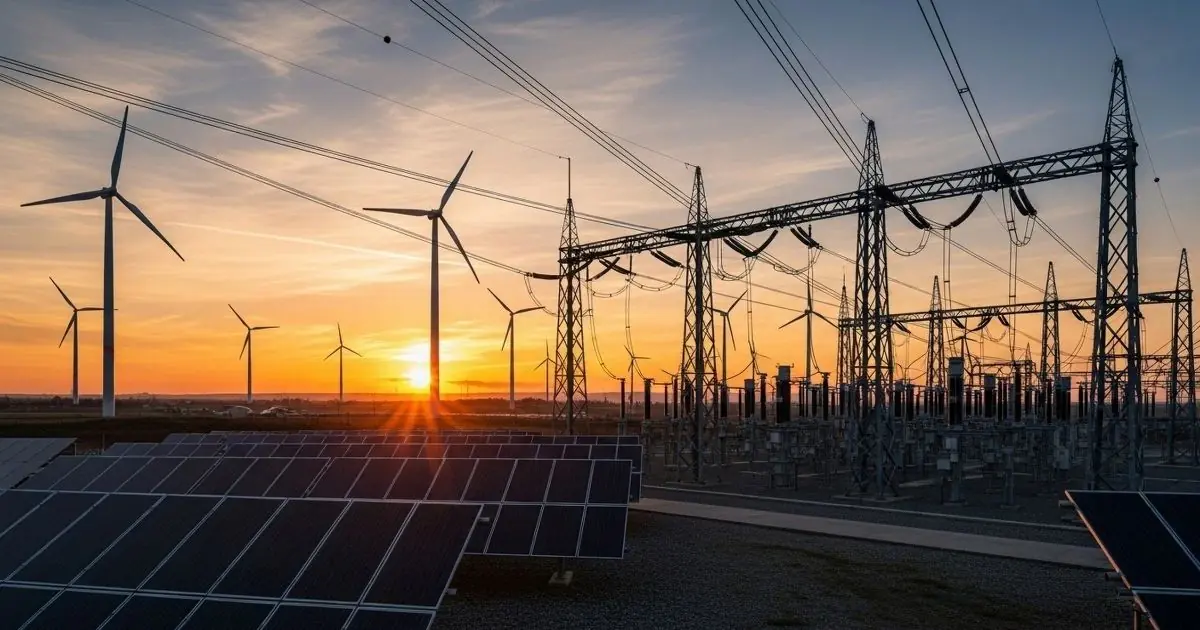
Earth Observation and satellite data are reshaping the energy industry by enabling data-driven decisions across infrastructure monitoring, risk mitigation, and renewable energy planning. Through geospatial intelligence, energy operators can assess climate-driven risks, optimize asset performance, reduce costs, and improve energy security. From thermal monitoring to flood prevention and photovoltaic potential estimation, Earth Observation supports a more efficient, resilient, and sustainable energy sector.
Article
Content
The sustainability challenges facing the energy sector
The energy sector is at the core of the global sustainability challenge. Energy-related activities are responsible for approximately 75% of global greenhouse gas emissions, with direct CO₂ emissions exceeding 37 gigatonnes per year in recent assessments. Despite rapid growth in clean energy, fossil fuels still account for over 80% of global primary energy supply, highlighting the scale and inertia of the transition facing the energy industry.
At the same time, global energy demand continues to rise. By 2030, electricity consumption alone is projected to increase by more than 25% compared to current levels, driven by urbanization, electrification of transport, and digital infrastructure. This creates a dual pressure: reducing emissions while ensuring reliability, affordability, and energy security. Power systems must decarbonize without compromising resilience, even as they become more exposed to climate-related risks.
Climate change is already amplifying operational challenges. Heatwaves reduce thermal power plant efficiency and constrain cooling systems, while droughts limit hydropower generation. According to international climate assessments, over one-third of global power capacity is expected to face increased water stress or temperature-related constraints in the coming decades. These dynamics are reshaping energy trends, pushing utilities and operators to rethink asset planning, grid management, and long-term investments.
Financial and regulatory pressures further intensify the sustainability challenge. Energy infrastructure damage from climate-related events generates hundreds of billions of dollars in annual losses, while new disclosure frameworks and climate policies require more transparent, data-driven decision-making. As a result, sustainability in the energy sector is no longer limited to emissions reduction.
It now encompasses climate adaptation, infrastructure resilience, and the integration of environmental intelligence into strategic and operational processes, forming the foundation for a more robust and future-proof energy system.
The role of satellite data and Earth Observation in the energy industry
The growing complexity of the energy industry is accelerating the adoption of satellite data and Earth Observation as strategic decision-support tools. Unlike traditional in-situ measurements, Earth Observation provides consistent, large-scale, and time-continuous information on environmental and climatic variables that directly influence energy infrastructure, operations, and planning. This capability is increasingly critical as energy systems expand geographically and become more exposed to climate variability.

Modern Earth Observation programs, such as those developed at European and global levels, deliver high-resolution data on land surface temperature, precipitation, soil moisture, vegetation dynamics, surface deformation, and extreme events. When transformed into geospatial data layers, these observations enable energy operators to assess site-specific conditions while maintaining a system-wide perspective. This dual scale—local accuracy combined with regional and global coverage—is particularly valuable for utilities managing distributed assets across diverse environments.
Satellite-based geospatial intelligence supports multiple phases of the energy lifecycle. During planning and development, it enables evidence-based site selection and environmental screening. During operations, it enhances monitoring of infrastructure performance and exposure to physical risks. Over the long term, Earth Observation contributes to trend analysis, allowing stakeholders to anticipate how climate-driven changes may affect energy demand, production efficiency, and asset reliability.
Crucially, satellite data shifts energy decision-making from reactive to proactive. By integrating Earth Observation into analytical workflows, the energy industry can move beyond static historical assumptions and adopt dynamic, forward-looking models. This data-driven approach strengthens resilience, improves sustainability outcomes, and supports more informed investment and operational strategies in an increasingly uncertain environmental context.
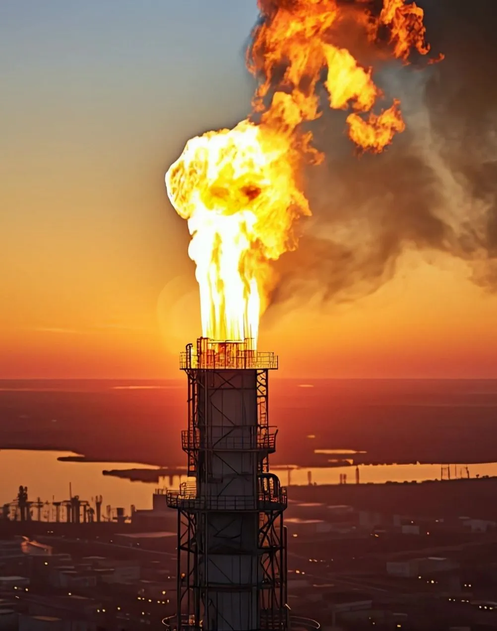
Thermal monitoring and energy infrastructure performance optimization
Thermal conditions play a critical role in the reliability and efficiency of energy infrastructure. Rising ambient temperatures, increasingly frequent heatwaves, and localized heat anomalies directly affect power generation, transmission, and distribution assets.
For the energy industry, the ability to monitor thermal behavior at scale has become essential to prevent performance degradation, operational overloads, and premature equipment failure.
Through satellite data and Earth Observation, thermal monitoring enables continuous assessment of land and surface temperatures across large geographic areas. Parameters such as Land Surface Temperature (LST) and heat persistence indicators provide objective insights into how environmental heat interacts with energy assets. These datasets allow operators to identify thermal stress hotspots affecting substations, power plants, storage facilities, and urban energy infrastructure—areas where elevated temperatures can reduce efficiency and increase fault probability.
.webp)
Geospatial thermal intelligence also supports the analysis of energy demand patterns. High surface temperatures are strongly correlated with peak electricity consumption driven by cooling needs, particularly in urban and industrial areas. By integrating satellite-derived thermal layers into operational workflows, energy providers can better anticipate demand surges, optimize load distribution, and reduce the risk of system overloads during extreme heat events.
Advanced infrastructure monitoring benefits further from the combination of temperature data with heat persistence metrics. Persistent heat anomalies may indicate chronic stress conditions rather than temporary weather-driven fluctuations. Tools that analyze heat persistence over time enable early detection of vulnerable zones, supporting predictive maintenance strategies and more efficient asset management.
From an energy efficiency perspective, thermal monitoring contributes to minimizing losses and improving system performance. By shifting from reactive responses to proactive thermal risk management, energy operators can reduce downtime, extend asset lifespan, and enhance overall network resilience. In an increasingly climate-sensitive context, satellite-based thermal monitoring is becoming a foundational capability for optimizing energy infrastructure performance and ensuring long-term operational stability.
Environmental risk prevention through geospatial intelligence
Environmental risks are a growing determinant of energy security, as climate-driven hazards increasingly threaten critical infrastructure and operational continuity. Earth Observation enables a shift from reactive risk management to proactive prevention by providing consistent, spatially explicit insights on flood exposure, terrain stability, and environmental dynamics.
When translated into actionable geospatial data, satellite-derived information supports systematic risk screening across large asset portfolios, allowing energy operators to identify vulnerable locations, prioritize mitigation measures, and strengthen infrastructure resilience. Integrating geospatial intelligence into risk frameworks is now essential to protect energy assets, reduce disruption impacts, and ensure long-term system reliability under evolving climate conditions.
Flooding risk assessment for energy infrastructure resilience
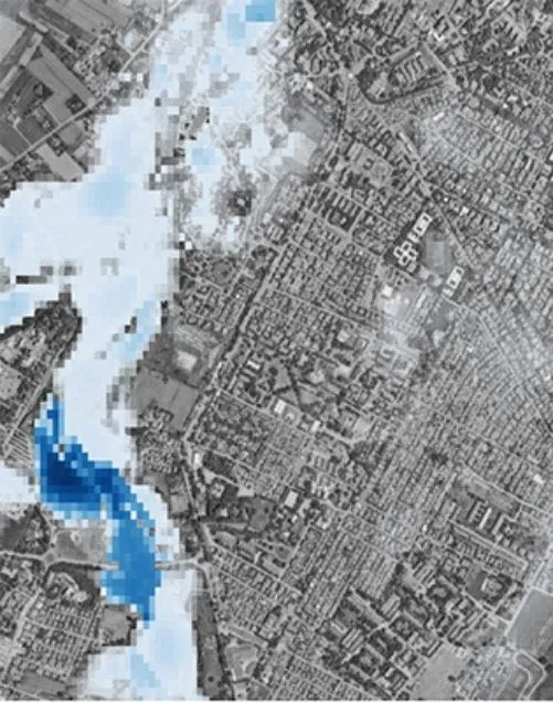
Flooding represents a critical threat to energy infrastructure, with direct consequences for operational continuity and energy security. Satellite-based flooding risk assessment enables a spatially explicit evaluation of exposure by combining terrain morphology, hydrological patterns, land cover, and historical flood dynamics into a single analytical framework. This approach allows energy operators to identify assets located in flood-prone areas, including power plants, substations, storage facilities, and transmission corridors.
By leveraging satellite data, flood risk can be assessed consistently across large territories, overcoming the limitations of localized surveys and static hazard maps. Geospatial flood layers support both strategic planning and operational risk management, enabling scenario analysis, asset prioritization, and targeted mitigation measures. Integrating flooding risk intelligence into energy infrastructure planning reduces the likelihood of unplanned outages, limits damage to critical equipment, and strengthens system resilience in the face of increasingly frequent and intense extreme precipitation events.
Vegetation management and grid safety with tree height estimation
Vegetation encroachment is a persistent operational risk for the energy sector, particularly for overhead transmission and distribution networks. Trees growing beyond safety thresholds are a leading cause of power outages, equipment damage, and wildfire ignition near power lines. Effective vegetation management is therefore essential to ensure infrastructure safety and service reliability.
.webp)
Satellite-derived tree height estimation transforms this process by providing consistent, large-scale geospatial data on vegetation structure and growth dynamics. Instead of relying solely on periodic field inspections, energy operators can continuously monitor tree heights along transmission corridors, identify critical clearances, and prioritize maintenance interventions based on objective risk indicators.
This data-driven approach improves the efficiency of vegetation management programs, reduces inspection costs, and minimizes unplanned outages, while supporting safer and more resilient grid operations across extensive and often remote territories.
Seismic risk assessment for long-term energy asset protection
Seismic activity represents a low-frequency but high-impact threat to critical energy infrastructure, with potentially severe consequences for energy security and long-term asset reliability. Power plants, pipelines, substations, and storage facilities located in seismically active regions require robust risk evaluation frameworks that go beyond historical records alone.
.webp)
Earth Observation contributes to seismic risk assessment by enabling the continuous analysis of ground deformation, fault proximity, and terrain stability over large areas. Satellite-based geospatial indicators support the identification of zones where tectonic stress accumulation or surface displacement may increase infrastructure vulnerability.
Integrating seismic intelligence into energy asset planning and monitoring allows operators to prioritize reinforcement measures, inform site selection, and enhance resilience strategies.
This forward-looking approach is essential to protect long-lived energy assets and ensure operational continuity in regions exposed to seismic hazards.
Latitudo40 is currently developing a dedicated seismic risk assessment layer designed to support long-term energy infrastructure planning. The tool will combine satellite-based ground deformation analysis with geospatial hazard indicators, enabling early identification of seismic exposure and supporting informed decisions on asset protection and infrastructure resilience.
Supporting renewable energy systems with photovoltaic potential estimation
%20(1).webp)
The accelerated deployment of solar power is a cornerstone of decarbonization strategies across the energy sector, but its effectiveness depends on precise planning and site-specific analysis. Photovoltaic performance is highly sensitive to environmental variables such as solar irradiance, surface orientation, shading, and local climate conditions. As a result, generic suitability assessments often lead to suboptimal system sizing, underestimated risks, and reduced long-term returns.
Photovoltaic potential estimation based on geospatial data addresses these limitations by leveraging satellite-derived irradiance models and high-resolution surface analysis. By calculating the amount of solar energy reaching rooftops and land parcels, these models provide an objective, spatially explicit assessment of where photovoltaic systems can deliver the highest energy yield.
For rooftop installations, advanced estimation layers can further refine results by accounting for realistic deployment scenarios, such as limiting panel coverage to a defined percentage of usable roof surface, ensuring technically feasible and economically sound projections.
From a planning perspective, satellite-based photovoltaic assessment supports evidence-based decision-making at multiple scales. Utilities, developers, and public authorities can compare sites consistently, prioritize high-potential areas, and integrate solar generation into broader energy strategies.
This approach reduces uncertainty during early project phases, accelerates permitting processes, and improves alignment between energy production targets and spatial constraints.
Photovoltaic potential mapping also contributes indirectly to infrastructure safety. By guiding installations toward suitable locations and away from structurally or environmentally constrained surfaces, geospatial intelligence helps mitigate operational risks and long-term maintenance issues. As renewable energy systems become increasingly distributed, satellite-driven photovoltaic estimation emerges as a critical capability to ensure efficient, safe, and scalable solar deployment, supporting a resilient and sustainable energy transition.
Operational and economic impacts of Earth Observation in the energy industry
The integration of Earth Observation into energy operations is delivering measurable operational and economic value across the energy industry. By transforming satellite-derived environmental data into actionable intelligence, energy operators can significantly improve efficiency while reducing exposure to physical and financial risks. This shift is increasingly aligned with emerging energy trends focused on resilience, digitalization, and sustainability.
From an operational standpoint, geospatial intelligence enables earlier detection of stress conditions affecting infrastructure, supporting predictive maintenance and reducing unplanned outages. Industry analyses indicate that proactive risk monitoring can lower infrastructure downtime by 20–30%, while optimized maintenance scheduling can reduce operational expenditures by up to 15%. These improvements directly enhance energy security, particularly in systems managing geographically distributed assets.
Economic benefits are equally significant. Climate-related damages already generate hundreds of billions of dollars in annual losses for infrastructure-intensive sectors, including energy. Satellite-based risk mitigation strategies—covering flooding, thermal stress, and environmental exposure—help limit asset damage and extend infrastructure lifespan. Even marginal improvements in asset protection can translate into multi-million-dollar savings over the lifecycle of large-scale energy installations.
Earth Observation also improves investment efficiency. By reducing uncertainty in site selection and risk assessment, geospatial data lowers project development costs and minimizes the likelihood of stranded assets. As climate variability intensifies, the ability to quantify and manage environmental risks is becoming a competitive differentiator.
Ultimately, Earth Observation enables the energy industry to align cost reduction, operational efficiency, and risk mitigation within a single, data-driven framework that supports long-term sustainability and system resilience.

.webp)


.webp)


