Climate risk assessment made faster, clearer and more accurate

BOOK A PERSONALIZED PRODUCT DEMO

Trusted by insurers and infrastructure operators worldwide.

Get in touch

02

SOLUTION

Say Hi to
EarthDataInsights

Your unified platform for heat & flood exposure, predictive simulations, and regulator-ready climate indicators derived from satellite data.

BOOK A PERSONALIZED PRODUCT DEMO

98%

Cheaper than on-field monitoring

93%

Accuracy and precision monitoring

40%

Faster decision-making

TRUSTED BY

DETECT

Detect risk-prone areas and asset vulnerabilities instantly using satellite-based indicators.

MEASURE

Measure hazard, exposure, and land-use change with consistent, comparable risk KPIs.

SIMULATE

Simulate risk scenarios and predict their impact across portfolios and assets.

03.

explore

Urban Heat Island report in less than 2 minutes.

Play

From Intuition
to
Simulation

BOOK A PERSONALIZED PRODUCT DEMO

Asses your climate-risk exposure - before it impacts your portfolio

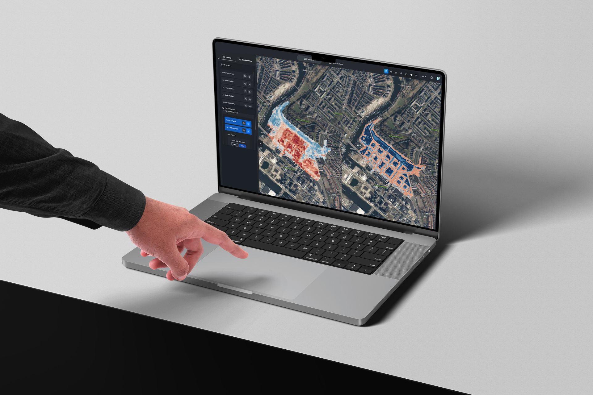
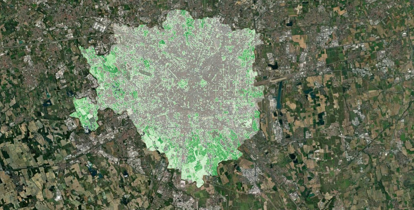
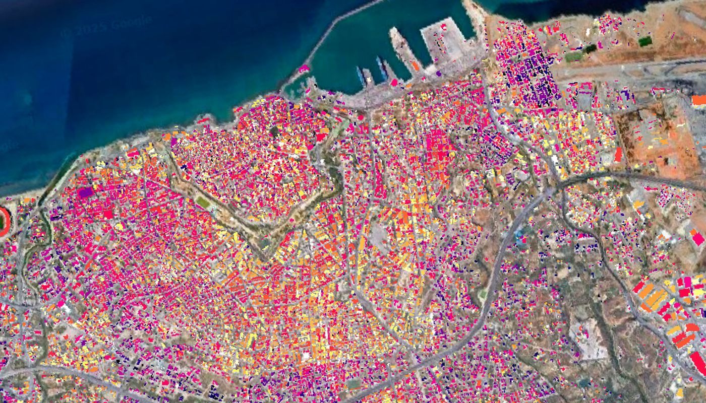
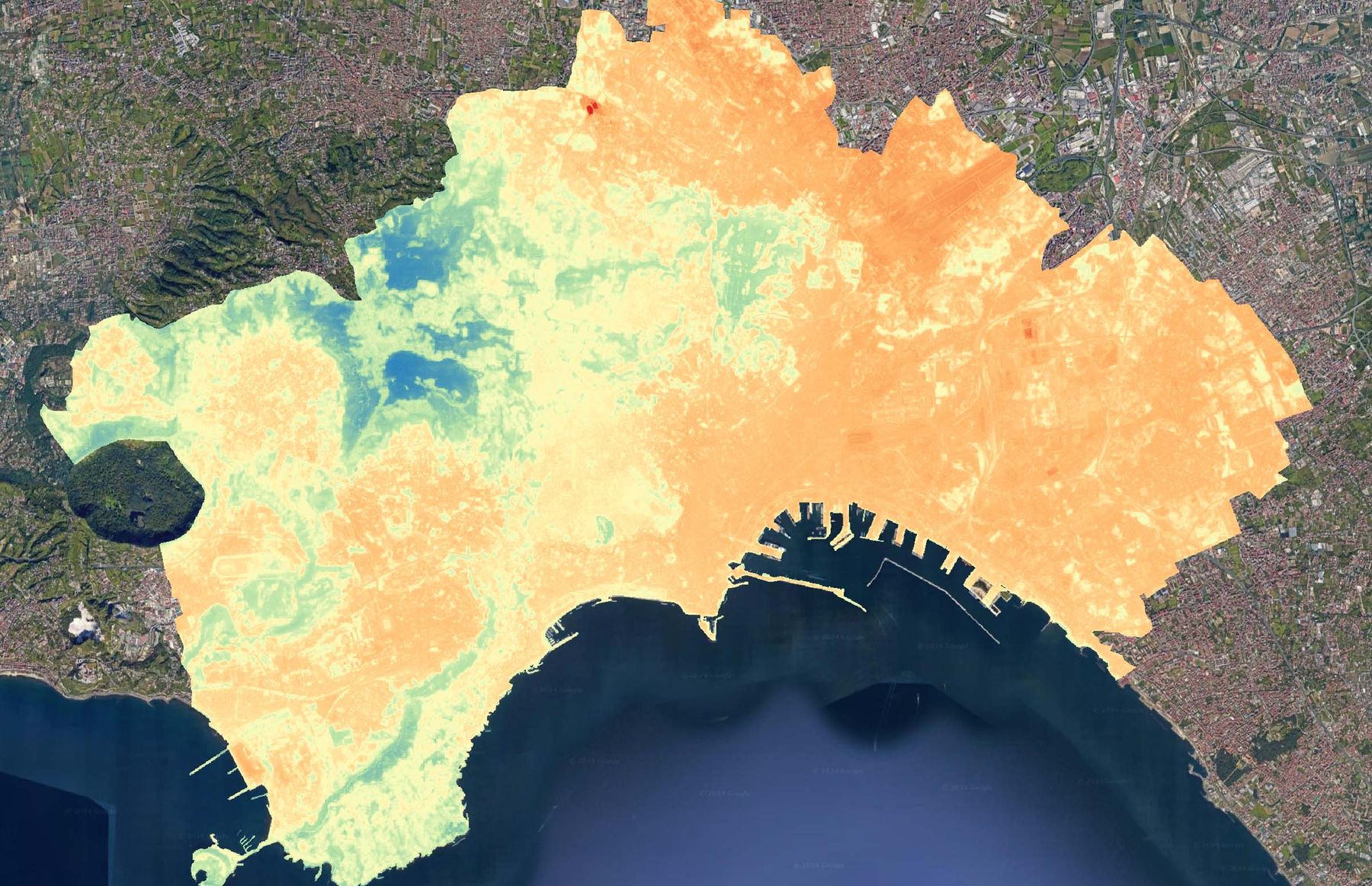
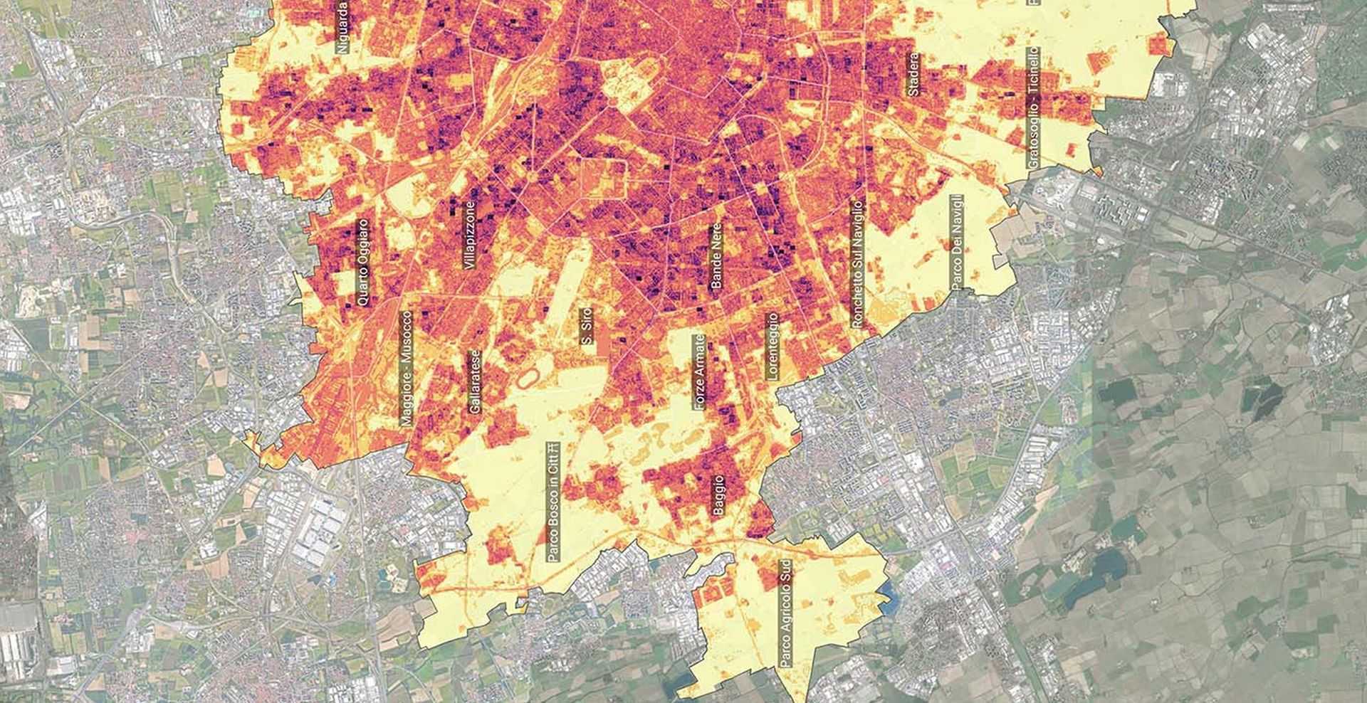
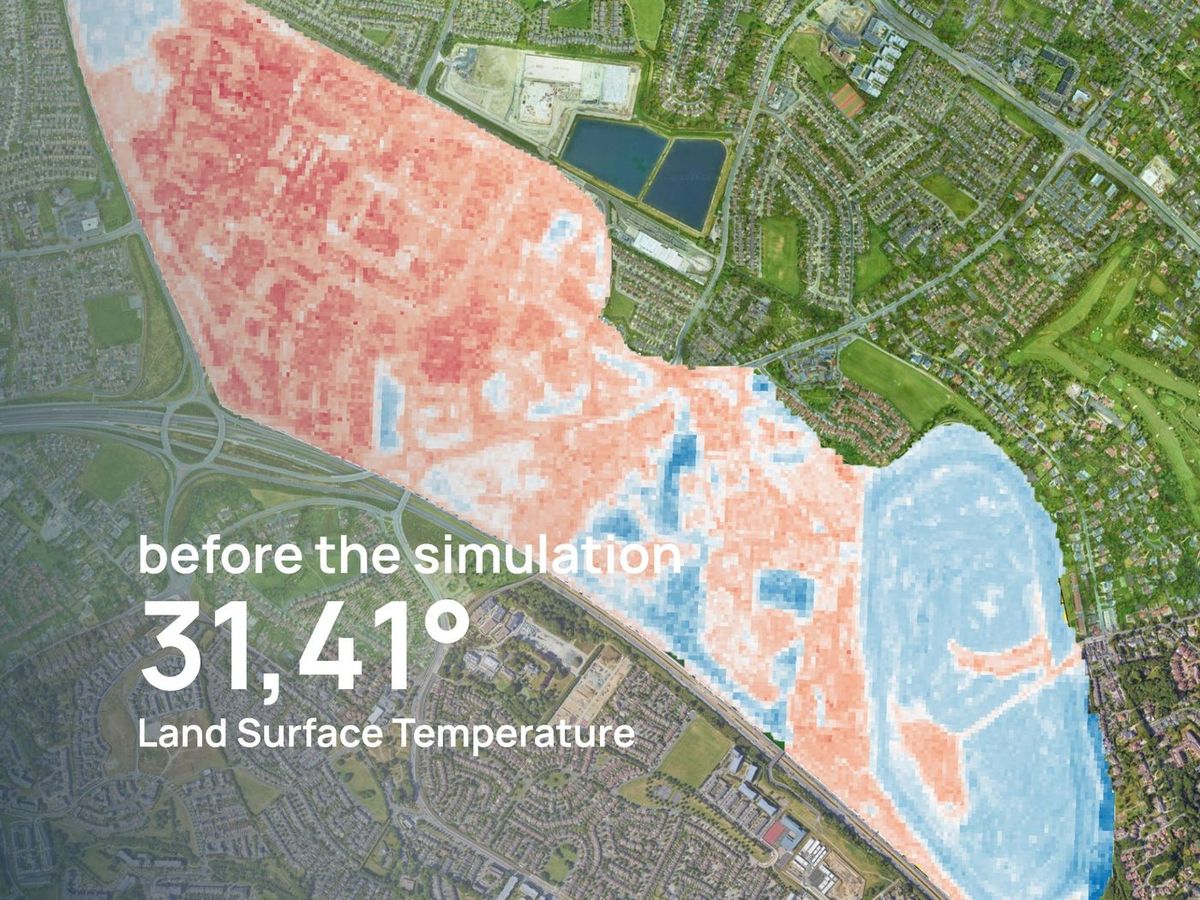
Detect. Measure. Simulate. Decide.
No more assumptions. Just evidence.

SIMULATION

With EarthDataInsights you can detect hazards, quantify exposure, and simulate risk scenarios to understand their impact on assets, portfolios, and regulatory reporting — all in one click.

Do you have a risk strategy?Understand if the thermal exposure is mitigated or not.. before underwriting anything.

left arrow iconright arrow icon

04

SIMULATION

You can assess unique sets of risk indicators.

BOOK A PERSONALIZED PRODUCT DEMO

HEATWAVE RISK MAP

PARK COOL ISLAND

MICROCLIMATIC PERFORMACE INDEX

flooding risk

urban heat island

land surface temperature

+14

more data

05

DOWNLOAD

Do not stress
anymore
with:

  • High cost of physical inspections
  • Static hazard maps that miss real exposure
  • Data scattered across multiple sources
  • Slow validation loops that delay underwriting
BOOK A PERSONALIZED PRODUCT DEMO

explore

together

explore

together

explore

together

explore

together